Massachusetts Middlesex County Vector Map - stock illustration
Massachusetts Middlesex County Vector Map. Blue-gray striped design, light shapes are urban areas, dark shapes are rural areas. All source data is in the public domain. U.S. Census Bureau. Used Layer: Census Tiger Tabblock.

Get this image in a variety of framing options at Photos.com.
PURCHASE A LICENCE
All Royalty-Free licences include global use rights, comprehensive protection, and simple pricing with volume discounts available
335.00 €
EUR
Getty ImagesMassachusetts Middlesex County Vector Map High-Res Vector Graphic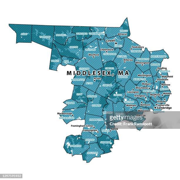 Download premium, authentic Massachusetts Middlesex County Vector Map stock illustrations from Getty Images. Explore similar high-resolution stock illustrations in our expansive visual catalogue.Product #:1297595932
Download premium, authentic Massachusetts Middlesex County Vector Map stock illustrations from Getty Images. Explore similar high-resolution stock illustrations in our expansive visual catalogue.Product #:1297595932335€50€
Getty Images
In stockDETAILS
Credit:
Creative #:
1297595932
Licence type:
Collection:
DigitalVision Vectors
Max file size:
4924 x 4924 px (41.69 x 41.69 cm) - 300 dpi - 8 MB
Upload date:
Location:
United States
Release info:
No release required
Categories:
- Massachusetts Illustrations
- Map Illustrations
- Newton - Massachusetts Illustrations
- Cambridge - Massachusetts Illustrations
- Lowell Illustrations
- Wakefield - Massachusetts Illustrations
- Waltham - Massachusetts Illustrations
- Cartography Illustrations
- Colour Image Illustrations
- Computer Graphic Illustrations
- Country - Geographic Area Illustrations
- Design Illustrations
- Digital Composite Illustrations
- Digitally Generated Image Illustrations
- District Illustrations
- Illustration Illustrations
- Medford - Massachusetts Illustrations
- Middlesex County - Massachusetts Illustrations
- National Border Illustrations
- No People Illustrations
- North America Illustrations
- Physical Geography Illustrations
- Square - Composition Illustrations
- Striped Illustrations
- USA Illustrations
- Vector Illustrations
- Watertown - Massachusetts Illustrations
- Winchester - Massachusetts Illustrations