davenport iowa 3d render map color top view apr 2019 - mississippi river satellite stock pictures, royalty-free photos & images
davenport iowa 3d render map blue top view apr 2019 - mississippi river satellite stock pictures, royalty-free photos & images
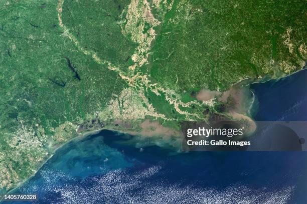
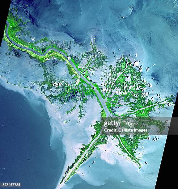
mississippi river delta, usa - mississippi river satellite stock pictures, royalty-free photos & images
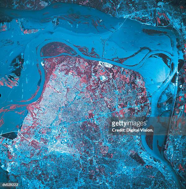
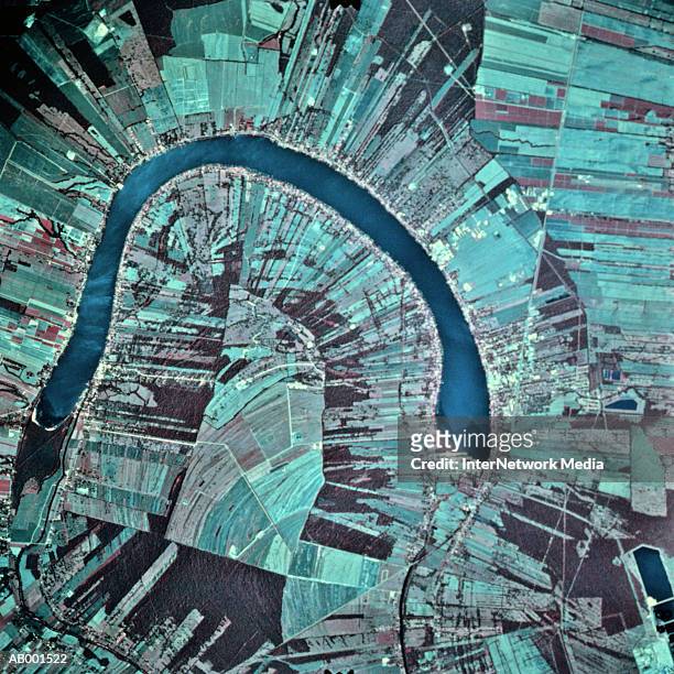
This is a satellite image of Mississippi River, New Orleans, Louisiana, United States showing the Crescent City Connection Bridge over the...
confluence of the missouri and mississippi rivers, missouri, usa - mississippi river satellite stock pictures, royalty-free photos & images
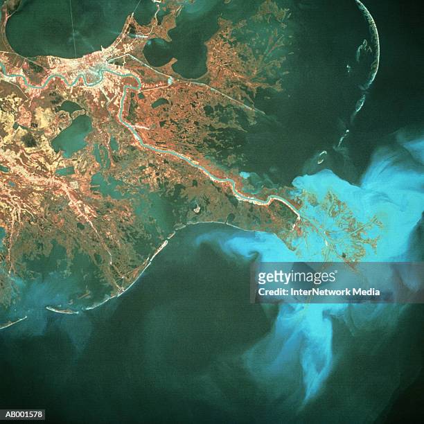
active delta front of the mississippi. this image was acquired on may 24, 2001 by the advanced spaceborne thermal emission and reflection radiometer (aster) on nasas terra satellite - mississippi river satellite stock pictures, royalty-free photos & images
The Morganza Spillway, a flood control structure along the western bank of the Mississippi River in Louisiana. May 18, 2011.
new orleans and mississippi river - mississippi river satellite stock pictures, royalty-free photos & images
This Image taken from NASA's Internet site 12 April, 2001 shows the sediment plume created by the flow of the Mississippi River as it flows into the...
satellite image of louisiana gulf coast, usa - mississippi river satellite stock pictures, royalty-free photos & images
As the summer 2012 drought continued to afflict the U.S. Midwest, water levels of the Mississippi River approached historic lows Aug. 24, 2012.
As the summer 2012 drought continued to afflict the U.S. Midwest, water levels of the Mississippi River approached historic lows Aug. 24, 2012.
True colour satellite image of the Mississippi River Delta. Turbid waters spill out into the Gulf of Mexico where their suspended sediment is...
mississippi river delta in the gulf of mexico - mississippi river satellite stock pictures, royalty-free photos & images
"united states east coast, satellite image" - mississippi river satellite stock pictures, royalty-free photos & images
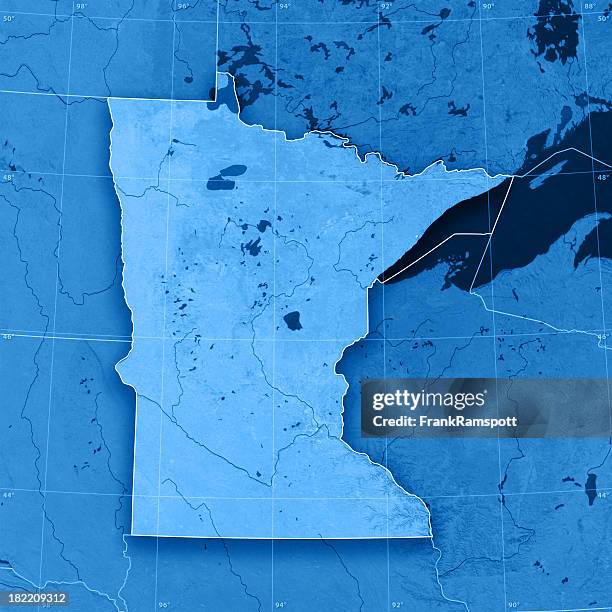
usa, minnesota, minneapolis, satellite image - mississippi river satellite stock pictures, royalty-free photos & images
the mouth of mississippi river from satellite - mississippi river satellite stock pictures, royalty-free photos & images
usa, tennessee, memphis, satellite image - mississippi river satellite stock pictures, royalty-free photos & images
In this handout from NASA, an oil slick from the sunk Deepwater Horizon drilling platform is seen near the Mississippi River Delta, from the...
In this handout image provided by NASA/CSTARS-University of Miami, MODIS on Terra, the growing extent of the oil spill is shown on April 29, 2010....
DigitalGlobe via Getty Images satellite image of the headwaters of the Mississippi River at Lake Itaska in Minnesota.
The Morganza Spillway, a flood control structure along the western bank of the Mississippi River in Louisiana. May 18, 2011.
may 10, 2011 - natural color satellite image of flood waters in memphis, tennesse. - mississippi river satellite stock pictures, royalty-free photos & images
As the summer 2012 drought continued to afflict the U.S. Midwest, water levels of the Mississippi River approached historic lows Aug. 24, 2012.
As the summer 2012 drought continued to afflict the U.S. Midwest, water levels of the Mississippi River approached historic lows Aug. 24, 2012.
Flooding along the Mississippi River at its junction with the Des Moines River near Keokuk, Iowa. April 30, 2011.
True colour satellite image of the Mississippi River Delta, Louisiana, USA. Turbid waters spill out into the Gulf of Mexico where their suspended...
True colour satellite image of the Mississippi River Delta, Louisiana, USA. Turbid waters spill out into the Gulf of Mexico where their suspended...
These images taken 25 April, 2000 and 18 April, 2001 released by NASA 20 April, 2001 show the result of a combination of high rains and melting snow...
This is a false color satellite image showing flooding near Cairo, Illinois. The blue is water and the yellow is healthy vegetation. Authorities...
In this handout satellite image provided by NASA Earth Observatory, the Morganza Spillway is seen from space by NASA's Earth Observing satellite on...
In this satellite image, flooding is shown in the Midwest May 5, 2011 at Cairo, Illinois. Authorities permitted residents to return to their homes in...