Los Angeles Map - stock illustration
A detailed map of the central area of Los Angeles, including Downtown, Hollywood, and Beverly Hills as well as areas south of Interstate 10. Includes major roads as well as highways, freeways, neighborhoods and points of interest, all on separate layers. An extra-large JPG is included so you can crop in to the area you need.

PURCHASE A LICENCE
All Royalty-Free licences include global use rights, comprehensive protection, and simple pricing with volume discounts available
335.00 €
EUR
Getty ImagesLos Angeles Map High-Res Vector Graphic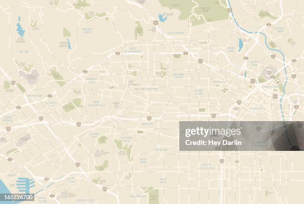 Download premium, authentic Los Angeles Map stock illustrations from Getty Images. Explore similar high-resolution stock illustrations in our expansive visual catalogue.Product #:165726700
335€50€
Getty Images
In stockDETAILS
Credit: Hey Darlin

Every visual at Getty Images is crafted through human expertise, creativity, and ingenuity. We do not allow AI-generated visuals in our library.
Creative #:
165726700
Licence type:
Collection:
DigitalVision Vectors
Max file size:
5564 x 3738 px (47.11 x 31.65 cm) - 300 dpi - 4 MB
Upload date:
Release info:
Model and property released
Categories:
- Map Illustrations
- City Of Los Angeles Illustrations
- Los Angeles County Illustrations
- Street Map Illustrations
- Road Map Illustrations
- Vector Illustrations
- California Illustrations
- Beverly Hills - California Illustrations
- Hollywood - California Illustrations
- Santa Monica Illustrations
- Downtown District Illustrations
- Motorway Illustrations
- Rodeo Drive Illustrations
- Westwood Neighborhood - Los Angeles Illustrations
- Griffith Park Illustrations
- Venice - California Illustrations
- Illustration Illustrations
- USA Illustrations
- City Illustrations
- Sunset Boulevard - Los Angeles Illustrations
- Sunset Strip Illustrations
- University of Southern California Illustrations
- West Hollywood Illustrations
- Bel Air Illustrations
- Cartography Illustrations
- Century City Illustrations
- Chinatown Illustrations
- Culver City Illustrations
- Dodger Stadium Illustrations
- Major Road Illustrations
- Melrose Avenue Illustrations
- No People Illustrations
- Road Illustrations
- Santa Monica Boulevard Illustrations
- Silver Lake - City of Los Angeles Illustrations
- Street Illustrations
- Transportation Illustrations
- Wilshire Boulevard Illustrations